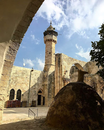
Sebastia Citadel (قلعة سبسطية) occupies the ancient acropolis of Sebastia, where successive cities controlled the historic routes between Nablus, Jenin, the…
Sebastia Citadel (قلعة سبسطية) occupies the ancient acropolis of Sebastia, where successive cities controlled the historic routes between Nablus, Jenin, the Jordan Valley and Palestine’s Mediterranean coast. The hill was fortified during the Iron Age, and excavations uncovered defensive walls, towers and buildings around its upper city. After later Assyrian, Persian and Hellenistic rule, Herod renamed the city Sebaste in honour of the Roman emperor Augustus and undertook a major building programme. The archaeological area preserves remains associated with this long urban history, including the acropolis, Roman theatre, basilica, forum and colonnaded street. Sebastia under Muslim rule Sebastia entered Muslim rule during the early Islamic conquest of Palestine. Following the Crusader period, it returned to Muslim rule after Salahuddin al-Ayubi’s victory at Hittin in 583 AH/1187. The wider site preserves later remains from the Ayyubid, Mamluk and Ottoman periods, while the geographer Yaqut al-Hamawi recorded Sebastia within the district of Nablus and the military province of Filastin. The citadel stands above the historic town of Sebastia, around ten kilometres northwest of Nablus. Within the town is the Mosque of Nabi Yahya (AS), where Islamic tradition holds that Nabi Yahya (AS) is buried. Together, the acropolis and the old town preserve Sebastia’s passage from an ancient fortified capital into a Palestinian town shaped by Islamic rule and local life.